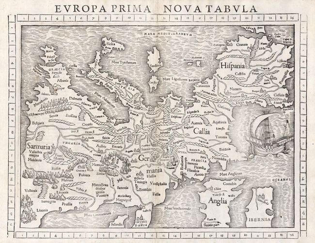
"Europa Prima Nova Tabula", Munster, Sebastian
Subject: Europe
Period: 1552 (published)
Publication: Geographia
Color: Black & White
Size:
13.3 x 10 inches
33.8 x 25.4 cm
This is one of the earliest obtainable maps of the European continent. Its unusual orientation, with north at the bottom of the sheet and the Mediterranean Sea at top, also makes it one of the most interesting maps of Europe. Mountains, forests, rivers and towns fill the land and in the Atlantic Ocean there is a large sailing ship. Sebastian Munster was the first to make individual maps of each continent, and this map is from that series. This is the only edition with the latitude and longitude grid printed in the margins. Latin text and illustrations on verso.
References:
Condition: A+
Good impression printed on quality paper. Faint foxing in margins, still fine.