Catalog Archive
Auction 107, Lot 135

"Map of the Southern Provinces of the United States", Rochefoucald Liancourt, Francois Alexander

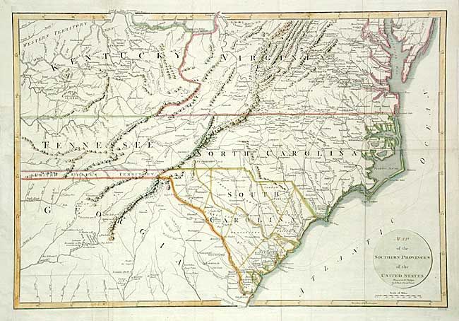
Subject: United States - Southern

Period: 1799 (circa)

Publication: Travels through the United States

Color: Hand Color

Size:
20 x 13.5 inches
50.8 x 34.3 cm
Download High Resolution Image
(or just click on image to launch the Zoom viewer)

Interesting map covering all of the Carolinas with parts of Virginia, Kentucky, Tennessee and Georgia. Great detail of early roads and settlements. Between Tennessee and Georgia is a long strip of land labeled United States Territory. This land originally belonged to South Carolina but was ceded back to the United States in 1787. Numerous Indian villages are shown, especially in the region of present-day Alabama. Engraved by J.C. Russell and published by R. Phillips.

References: Phillips (M) p. 873.

Condition: B

Issued folding, now pressed. Margin extended at binding trim including facsimile of neatline.

Estimate: $350 - $400

Sold for: $400

Closed on 6/9/2004

Archived