Subject: South Pole
Period: 1680 (circa)
Publication:
Color: Hand Color
Size:
19.2 x 17 inches
48.8 x 43.2 cm
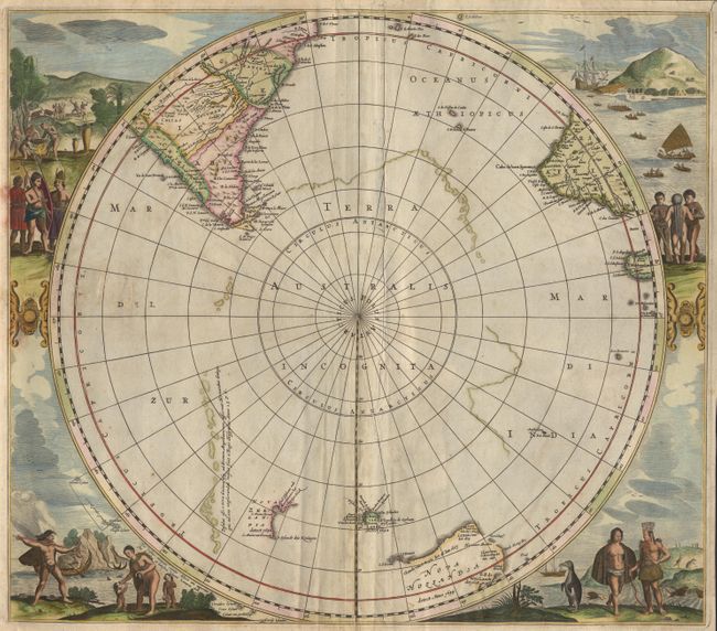
This is a re-issue of Hondius' important map of the South Pole. The circular south-polar projection shows part of South America, Africa, Madagascar and the incomplete coastlines of Antarctica and Australia. The title cartouche has been removed and parts of New Zealand, Van Diemans Land and the Islands of Amsterdam and Paulo have been added. The map is surrounded by full color engravings of natives in various scenes and visiting sailors coming ashore. No text and some acid burn on verso.
References: Tooley (MCC) 2-#24.
Condition: B
Paper repair of centerfold, repair of small hole, and a crease near fold.