Subject: World
Period: 1700 (circa)
Publication:
Color: Hand Color
Size:
18.5 x 15.6 inches
47 x 39.6 cm
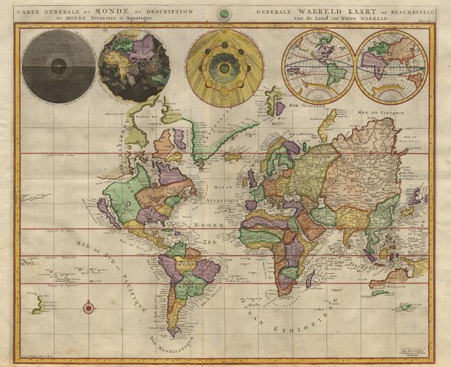
Beautiful world map from a Dutch Bible. The map is drawn on Mercator's projection with CALIFORNIA AS AN ISLAND and the "Detroit d'Anian" connected by dotted lines through the NORTHWEST PASSAGE to'Butons Bay' located to the west of Hudson Bay. In the Pacific is a small coastline of New Zealand. The northeast coast of Asia is severely truncated. Australia's northern coast is shown connected to New Guinea and a tiny part of Van Diemen's Land is depicted. Across the top of the map are five spheres depicting Day and Night, the Flood, the phases of the moon, and the Western and Eastern Hemispheres.
References: Shirley #622.
Condition: A
Excellent later color. Close bottom margin (1/8") as issued. Tiny separation of fold, repaired with archival tape.