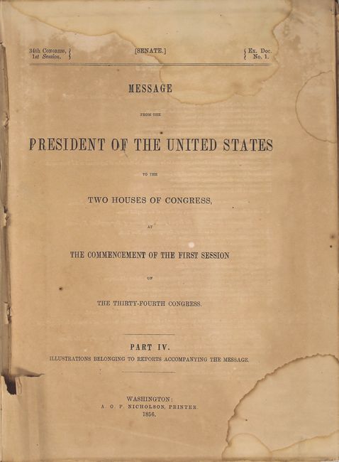
"Message from the President of the United States to the Two Houses of Congress ... Part IV...", U.S. Government
Subject: Exploration and Surveys
Period: 1856 (published)
Publication: Sen Ex. Doc. 1, 34th Cong., 1st Sess.
Color: Black & White
Size:
8.8 x 11.9 inches
22.4 x 30.2 cm
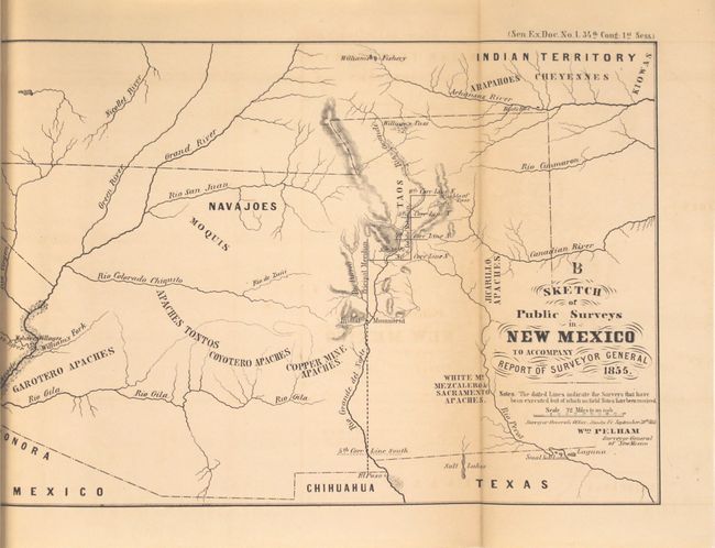
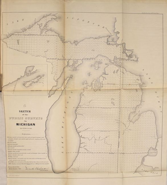
This is the complete volume of illustrations accompanying the reports submitted for the 1st session of the 34th Congress. The 35 illustrations are primarily from the General Land Office (16) and Bureau of Topographical Engineers (13), but also include a few from the Quartermaster General and Secretary of the Navy. Of particular interest in this volume are:
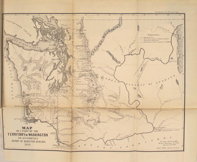
Map of a Part of the Territory of Washington to Accompany Report of Surveyor General (19.3 x 14.3"). This uncommon map was executed by James Tilton, Surveyor General, from the Olympia office. This is the first GLO map of Washington Territory, issued just 28 months after its creation. The map shows limited survey progress with modest detail west of the Cascades. In the east, only major rivers are shown. Several forts (Steilacom, Nisqually, Walla Walla, & Townsend) are located and Seattle is labeled Statle. Legend at upper right identifies surveyed lines, surveys under progress, townships subdivided, and proposed surveying for the 1856 & 57 season.
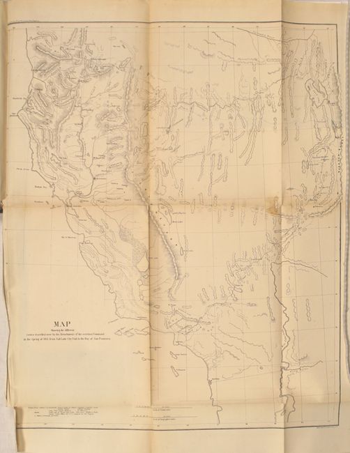
Map Showing the Different Routes Travelled over by the Detachments of the Overland Command in the Spring of 1855 from Salt Lake City, Utah to the Bay of San Francisco (18.5 x 22"). This uncommon map accompanied the "Report of Capt. R. Ingalls on the march of L. Col. Steptoe from Ft. Leavenworth to California" in 1854 and 1855. Wheat states "it is a document of first quality.. showing three important routes." Steptoe was looking for a new and shorter route from the Great Salt Lake to the Pacific Coast. In addition to the route chosen by Steptoe, the routes of two detachments are also traced - one under Capt. Ingalls, the other by Lt. Mowry. The map extends to include all of California and part of Oregon to above the Rogue River. It stretches eastward to name G.S. Lake City, the Mormon capital of Fillmore, Cedar City and Fort Yuma on the Colorado. References: Wheat (TMW) #868; Wagner & Camp #256.
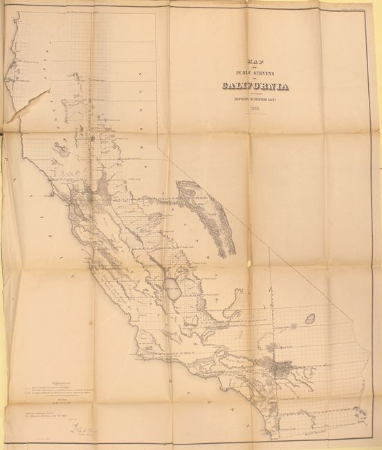
Map of Public Surveys in California... (36 x 30"). This large and remarkably detailed map delineates the progress of public surveys throughout the state on a scale of 18 miles per inch. About one-third of the state, in the north and east, remains unsurveyed. Lake Tahoe is shown fairly accurately, but is still called Bigler Lake. Printed on two sheets, joined as issued.
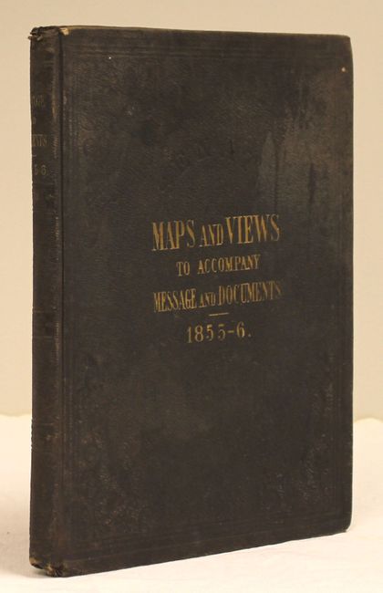
Hardbound in original embossed cloth boards with gilt titles on front cover and spine.
References:
Condition: B
Overall the maps are in good to very good condition in a few cases with light toning and occasional damp staining mainly along the folds. The map of California has an 8" binding tear and one tiny area of loss at a fold intersection. The map of Florida has a 12" binding tear. Title page is toned and damp stained. Covers are stained and rubbed.