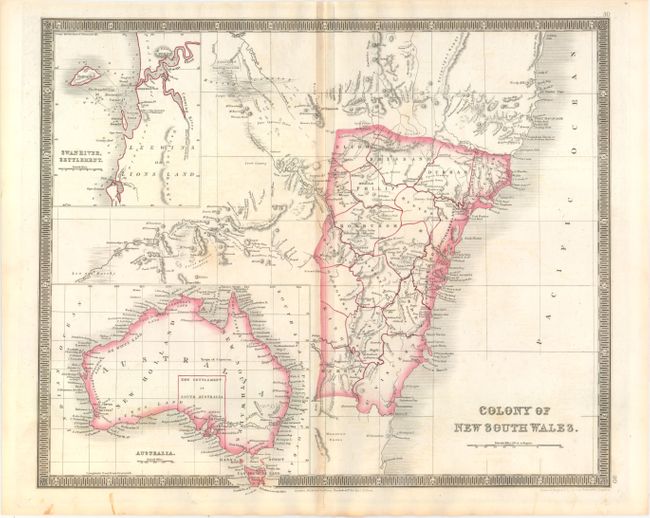
"Colony of New South Wales", Teesdale, Henry
Subject: Australia
Period: 1837 (circa)
Publication: A New General Atlas of the World
Color: Hand Color
Size:
16.2 x 13.4 inches
41.1 x 34 cm
This detailed map of New South Wales is divided into counties and shows good topographical detail and interesting notations including "impassable range of Rocky Ms." and "inundated country covered with reeds." Features insets of Swan River Settlement and the continent of Australia, noting the "new settlement of South Australia." Surrounded by a keyboard style border.
Henry Teesdale was a prominent London publisher and founding fellow of the Royal Geographical Society. He produced large-scale maps and charts and a number of fine atlases in the early part of the nineteenth century. He employed the most skilled draftsmen and engravers and his maps are renowned for precise detail and fine coloring. His maps are increasingly scarce on the market.
References: Tooley (Australia) #457.
Condition: B+
Original color on watermarked paper (J. Whatman 1837) with light toning along the centerfold.