First Known Map Devoted to Japan
"Ciampagu [on verso] Iava Majjiore", Bordone, Benedetto
Subject: Japan
Period: 1528 (circa)
Publication: Isolario
Color: Hand Color
Size:
5.8 x 3.4 inches
14.7 x 8.6 cm
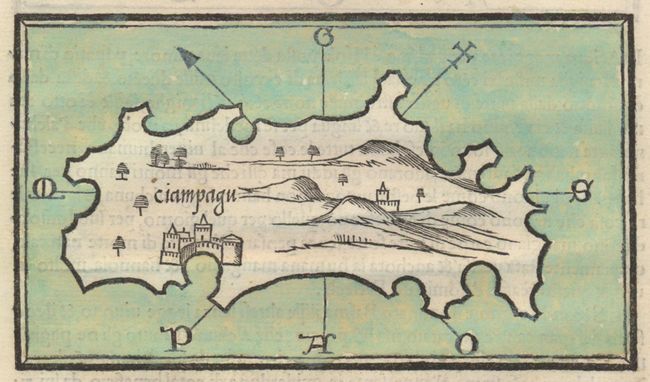
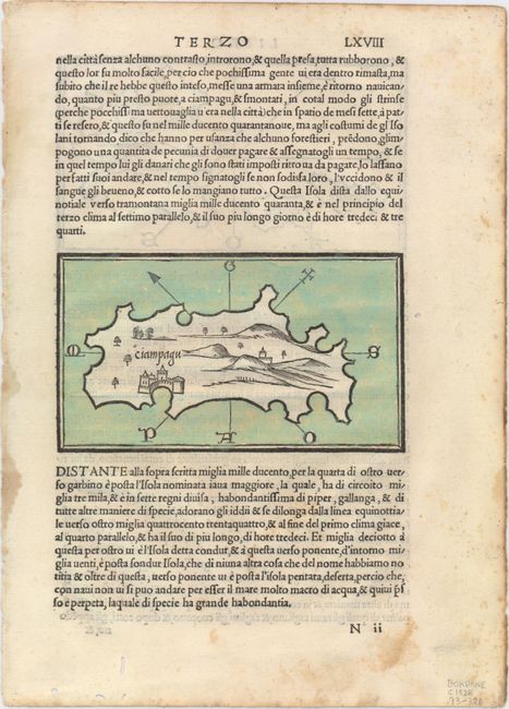
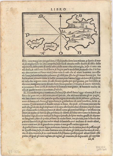
This is the earliest known printed map devoted to Japan. The map shows a single island with an east-west orientation and the position of a major city roughly where Kyoto or Osaka is located on the main island of Honshu. Since the map was based solely on the writings of Marco Polo, any approximation to reality is probably coincidence. The map is included in the middle of a page of Italian text. The verso contains an equally important early map of the East Indies showing three islands. This map is again based on the writings of Polo and while it names Java (Iava Majjiore), the location suggests a possible view of Borneo and confusion about the numerous islands of this region. Sondur and Condur, known today as Con Son Island, are the other islands named. On a full sheet of Italian text that measures 8.4 x 11.6".
Bordone's Isolario was one of the earliest and most important works of its time. It is remarkable for being the first atlas covering the entire world not based on classical geography, but rather on contemporary information. Bordone was an illuminator and wood-engraver working in Venice, when he was given permission by the Senate to print maps of Italy and the world. None of those maps have survived and his only remaining works are the maps from the Isolario (Island Book).
References: Walter #5: Suarez (SEA), pg. 120.
Condition: B+
Nice impressions with minor show-through of text on verso. There is light scattered foxing, a few small worm tracks, and a small damp stain, all confined to the blank margins