Catalog Archive
Auction 150, Lot 619

"Chorographie de l'Empire de la Chine...", Philippe De Pretot, Etienne Andre

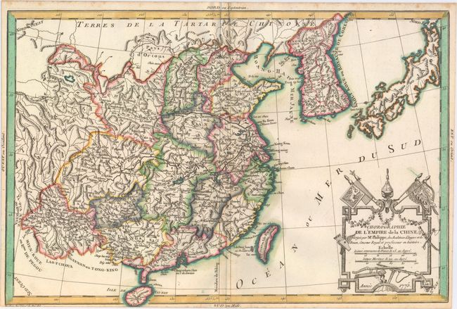
Subject: China, Korea & Japan

Period: 1775 (dated)

Publication:

Color: Hand Color

Size:
16.4 x 10.9 inches
41.7 x 27.7 cm
Download High Resolution Image
(or just click on image to launch the Zoom viewer)

This charming map shows China, Korea (Kaoli Koue ou Royaume de Coree), and Japan. Political divisions, towns and cities, rivers, and mountains are located in China and Korea, and the Great Wall of China is depicted. There are no place names in Japan, just topographical detail. The decorative title cartouche at bottom right features flags and weaponry. Engraved by Mathieu.

References:

Condition: A

A nice impression with a narrow, but adequate, bottom margin.

Estimate: $240 - $300

Sold for: $275

Closed on 9/17/2014

Archived