NO RESERVE
"[Lot of 2] China the Interior Chiefly from Du Halde and the Jesuits 1710 to 1718 and the Sea Coast from Modern Authorities [and] Chine Proprement dite Partie Sud-Est de l'Empire Chinois",
Subject: Eastern China
Period: 1843-60 (circa)
Publication:
Color: Hand Color
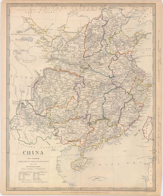
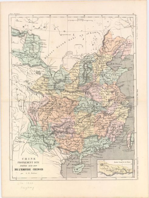
This pair of 19th century maps shows eastern China in great detail. Both maps depict political divisions, towns and cities, roads, canals, and topography. Each locates the Great Wall of China and extends to include Thibet, Hainan, and Formosa.
A. China the Interior Chiefly from Du Halde and the Jesuits 1710 to 1718 and the Sea Coast from Modern Authorities, by SDUK Society for the Diffusion of Useful Knowledge, dated 1843 (12.5 x 15.5"). The routes of the Macartney Embassy and later ambassador William Amherst are traced. A key at bottom provides translations for some key terms on the map. Engraved by J. & C. Walker and published by Chapman & Hall. Condition: Original outline color with a few edge tears and minor toning along the sheet's edges.
B. Chine Proprement dite Partie Sud-Est de l'Empire Chinois, by Auguste-Henri Dufour, from Atlas Populaire, circa 1860 (9.6 x 12.5"). There is a small inset at bottom right that focuses on northwest China. Engraved by Erhard Schieble and published by Gustave Barba. The lithography was handled by Tanneur et Compan. Condition: A few faint spots.
References:
Condition: A
See description above.