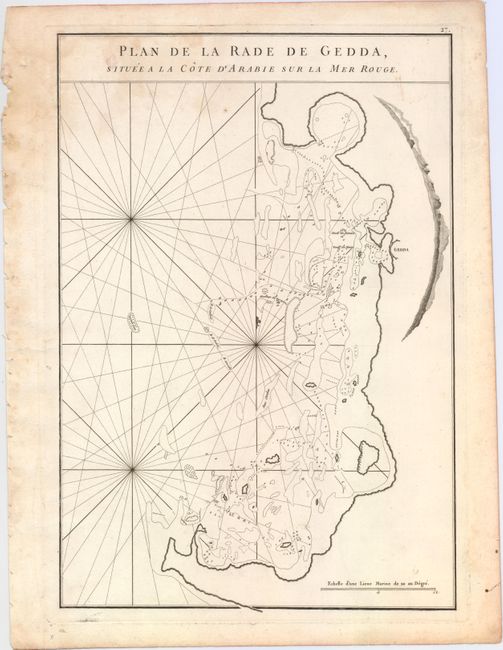
"Plan de la Rade de Gedda, Situee a la Cote d'Arabie sur la Mer Rouge", Apres de Mannevillette, Jean B. N. D.
Subject: Saudi Arabia
Period: 1775 (circa)
Publication: Le Neptune Oriental
Color: Black & White
Size:
13.2 x 19.2 inches
33.5 x 48.8 cm
This handsome sea chart covers the central portion of the western coast of present-day Saudi Arabia. Jeddah, the largest port on the Red Sea and a major gateway to Mecca, is the only city shown. The rest of the detail is confined to the sea, which is filled with rhumb lines, soundings, hazards, shoals, and anchorages.
A French sailor and hydrographer, D' Après de Mannevillette (1707-1780) used new instruments to correct the latitudes measured by previous explorers. His atlas Le Neptune Oriental, first published in 1745, was considered a major achievement and an indispensable resource for navigators.
References: Shirley (BL Atlases) M.APR-1c.
Condition: B+
A dark impression on sturdy, watermarked paper with light soiling and a damp stain that enters the image at top left.