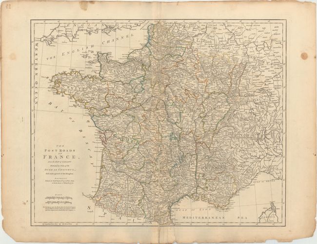
"The Post Roads of France, from the Map of Jaillot...", Kitchin, Thomas
Subject: France
Period: 1772 (dated)
Publication: General Atlas
Color: Hand Color
Size:
22.7 x 18.4 inches
57.7 x 46.7 cm
This detailed map of France is based on Jaillot's map of the late seventeenth century, which was one of the earliest postal maps of the country. Postal routes appear along with provinces, numerous towns and cities, mountains, lakes, and rivers. The distances between posts are indicated. The map extends to include the English Channel and parts of the Netherlands, Germany, Switzerland, Italy, and Corsica.
References: Phillips (A) #653-14.
Condition: B
A nice impression on sturdy watermarked paper with original color, a 7.5" centerfold separation at bottom that has been closed on verso with linen and some minor toning, mostly concentrated along the centerfold. There are short edge tears and a few stains confined to the blank margins.