"[Lot of 2] Scotland [and] Scotland",
Subject: Scotland
Period: 1855-60 (circa)
Publication:
Color: Hand Color
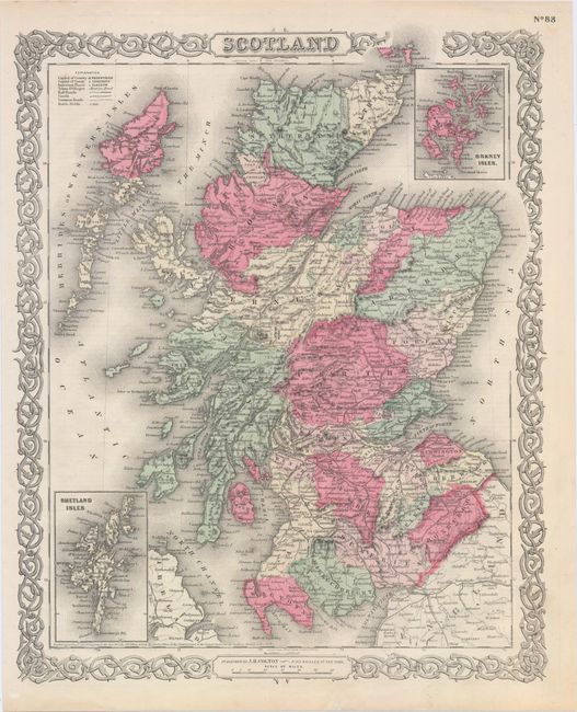
A. Scotland, by Joseph Hutchins Colton, from General Atlas, dated 1855 (12.9 x 15.9"). This steel-engraved map of Scotland shows counties, notable towns and cities, railroads, canals, and common roads. Several mountains are named along with their elevations, and historical battlefields are located with crossed swords and the date of the battle. An inset at top right depicts the Orkney Isles, and another at bottom left focuses on the Shetland Isles. Surrounded by a decorative scroll border. Condition: A few faint, unobtrusive spots.
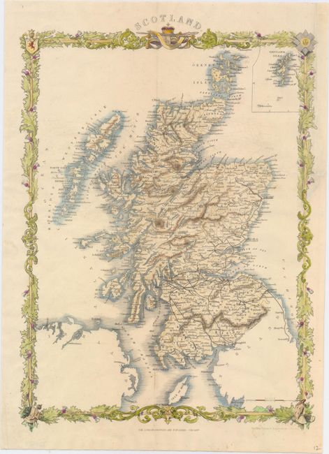
B. Scotland, by John Rapkin, circa 1860 (9.9 x 13.9"). This impressive map of Scotland features excellent detail of the counties, towns and cities, and topography. An inset in the upper right corner zeroes in on the Shetland Islands. Enclosed in an elegant border. This is a later edition of the similar Tallis map, with updates and no vignettes, published by the London Printing and Publishing Company. Condition: Issued folding with a binding trim at upper right that has been replaced with old paper and an associated binding tear just touching the border that has been closed with archival materials.
References:
Condition: A
Minor toning primarily in the blank margins.