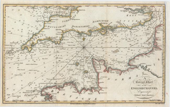
"A Correct Chart of the English Channel Engraved for Malham's Naval Gazetteer", Malham, John (Rev.)
Subject: Southern England
Period: 1795 (dated)
Publication: Malham's Naval Gazetteer
Color: Hand Color
Size:
12.3 x 7.5 inches
31.2 x 19.1 cm
This elegant chart centers on the English Channel and identifies many towns and cities, smaller islands, soundings, anchorages, and bottom types. England is shown as far north as London, while the French coastline extends from Calais to south of Brest. Bristol Channel, River Thames, the Seine, and the Straits of Dover all appear. A compass rose capped with a fleur-de-lis and radiating rhumb lines lies at center. The chart was engraved by Neele for Rev. John Malham (1747-1821), a writer and teacher of navigation, for a British edition of The Naval Gazetteer; or, Seaman's Complete Guide.
References: McCorkle (18th C. Geography Books) #251, Vol. I-9.
Condition: B+
A crisp impression issued folding that has been remargined at right with old paper with four tiny binding holes along the neatline, also at right.