Catalog Archive
Auction 150, Lot 390

"Carte de Maidenland ou de la Virginie de Hawkins, Decouverte par Sir Richard Hawkins en 1574, et du Canal Falkland ainsi Appelle par le Capne. Jean Strong qui le Traversa en 1689. Sur le Farewell Vaisseau de Londres", Benard, Robert

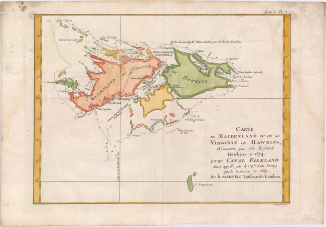
Subject: Falkland Islands

Period: 1760 (circa)

Publication:

Color: Hand Color

Size:
11.8 x 8.7 inches
30 x 22.1 cm
Download High Resolution Image
(or just click on image to launch the Zoom viewer)

This striking chart of the Falkland Islands shows many harbors, channels, capes, bays, shoals, islands, rocks, and soundings. The title erroneously claims that Sir Richard Hawkins discovered the Falkland Islands in 1574, when he would have been twelve years old. Hawkins did map the northern coastline of what may have been the islands in 1593, but the islands appeared on charts before that date. The map identifies a rock named by Hawkins and traces the track of Capt. John Strong's exploration in 1689, when he discovered the sound in between the two main islands.

References:

Condition: B+

On watermarked paper with faint damp stains that enter the map in the top corners and minor offsetting.

Estimate: $160 - $200

Sold for: $80

Closed on 9/17/2014

Archived