Catalog Archive
Auction 150, Lot 388

NO RESERVE

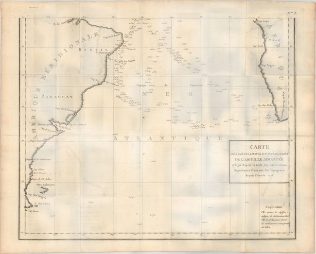
"[On 2 Sheets] Carte des Declinaisons et Inclinaisons de l'Aiguille Aimantee Redigee d'Apres la Table des Observations Magnetiques Faites par les Voyageurs Depuis l'Annee 1775", Buffon, Comte de

Subject: Atlantic Ocean

Period: 1780 (circa)

Publication: Histoire Naturelle Histoire des Mineraux

Color: Black & White

Size:
21 x 16.7 inches
53.3 x 42.4 cm
Download High Resolution Image
(or just click on image to launch the Zoom viewer)

This chart, printed on two sheets, came from a series of 8 maps published in the scarce mineralogy section of Buffon's Historie Naturelle. The variations in terrestrial magnetism at different points on the earth's surface are indicated throughout the map, especially along the western coast of Africa and eastern coast of South America. Only the outlines of the continents are depicted along with a few place names. If joined together, the chart would measure 20.5 x 33.5".

References:

Condition: B

Issued folding on heavy, watermarked paper with moderate offsetting and light scattered foxing. Please note that the blue hue in the image is caused by our scanner and not in the physical map.

Estimate: $250 - $325

Sold for: $70

Closed on 9/17/2014

Archived