NO RESERVE
"[Lot of 2] Venezuela, New Grenada & Equador [and] Map of New Granada Venezuela, and Guiana [on sheet with] Map of Peru, and Equador [and] Map of the Argentine Confederation", Mitchell, Samuel Augustus
Subject: South America
Period: 1850-60 (circa)
Publication:
Color: Hand Color
Size:
15.2 x 12.4 inches
38.6 x 31.5 cm
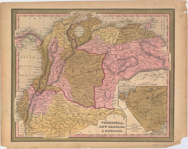
A. Venezuela, New Grenada & Equador, circa 1850 (15.2 x 12.4"). This detailed map of the northern part of South America stretches from Panama down to Ecuador and goes as far east as Essequibo River. It identifies political divisions, many towns and cities, native tribes, rivers, and mountains. An inset, Plan of a Proposed Communication Between the Atlantic & Pacific Oceans, appears at bottom right. Condition: There is faint scattered foxing, two minor mis-folds, and a few small chips and light toning in the blank margins. (B+)
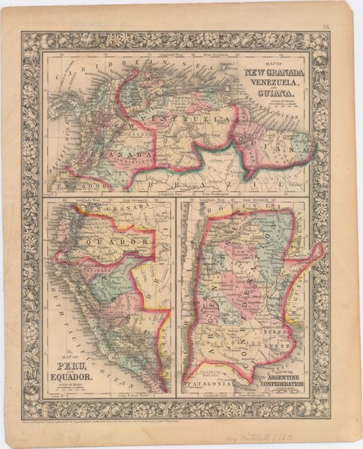
B. Map of New Granada Venezuela, and Guiana [on sheet with] Map of Peru, and Equador [and] Map of the Argentine Confederation, from New General Atlas, dated 1860 (10.7 x 13.4"). This sheet features three detailed maps within the decorative floral border. The first depicts the northern part of South America, where Colombia is called New Granada. At bottom left is a map of Ecuador and Peru. The Argentine Confederation is the focus of the map at bottom right. It depicts the northern portion of present-day Argentina and stretches south to show a little of Patagonia. The maps locate Monte Video, Quito, Lima, Truxillo, Bogata, and much more. Condition: A few faint spots in the image. (A)
References:
Condition:
See description above.