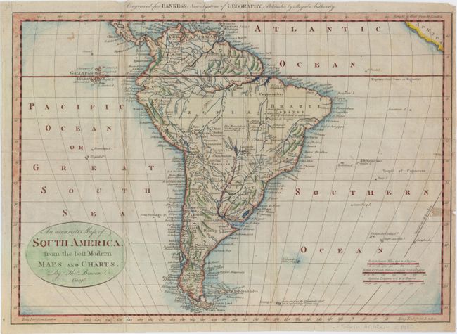
"An Accurate Map of South America, from the Best Modern Maps and Charts", Bowen, Thomas
Subject: South America
Period: 1788 (circa)
Publication: Bankes's New System of Geography
Color: Hand Color
Size:
18.1 x 12.8 inches
46 x 32.5 cm
This delicately engraved map of the continent features simple interior topography. The map is full of place names and locates many native tribes. The interior is mostly blank with some notes of waterfalls and rivers in the Amazon basin. The coastal areas are well detailed, and the Galapagos Islands are noted and named, as well as a phantom island near the southern tip named Peppy's I. Imaginary.
References:
Condition: B
Issued folding with several short edge tears and separations that just enter the image at bottom which have been closed on verso with archival material. There is light soiling and a few extraneous creases along the folds.