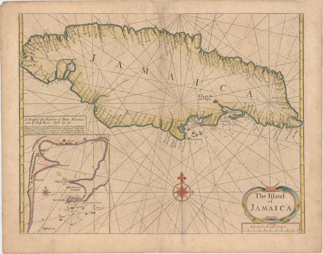
"The Island of Jamaica", Thornton, John
Subject: Jamaica
Period: 1689 (circa)
Publication: The English Pilot
Color: Hand Color
Size:
20.8 x 16.1 inches
52.8 x 40.9 cm
Large, handsome sea chart of the island with an inset of the Port Royal Harbor and sailing instructions. Shows harbors, shoals, navigational hazards and landmarks, parishes, towns and forts along the coastline. The map is embellished with a strapwork title cartouche, compass rose and rhumb lines. This map appeared in many issues of The English Pilot, until it was replaced with a new chart in 1773.
References: Kapp (MCC-42) #34; Seller & Van Ee #1915.
Condition: B
Watermarked paper with light printer's ink residue and soiling. There is an archivally repaired chip at top along centerfold that enters 1/2" into image.