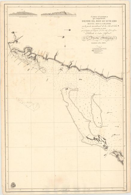
"Carta Esferica que Comprehende desde el Rio Guaurabo Hasta Boca-Grande en la Parte Meridional de la Isla de Cuba", Direccion de Hidrografia
Subject: Cuba
Period: 1805 (dated)
Publication: Atlas Maritimo Espanol
Color: Black & White
Size:
22.7 x 34.8 inches
57.7 x 88.4 cm
This crisp and detailed Spanish map of the southern coast near present-day Trinidad includes coastal features, anchorages, soundings, navigational hazards, currents, coastal islands and settlements. At top are profile views of the Trinidad and the Sancti Spiritus mountains as viewed from the water. Drafted by Jose del Rio who began his military service in 1775, traveled to Havana in 1776, and became a commissioned captain in 1794. During his land duty he was attached to the Hydrographic Office where he drew various plans of Cuba, Eastern Florida and the mosquito coast of Central America.
Spanish sea charts are rarely offered on the market, especially from this very rare first edition.
References: Cueto #58; Phillips (A) #4155-19.
Condition: B+
On watermarked paper with some light foxing and staining. Overall very good condition for a large sea chart.