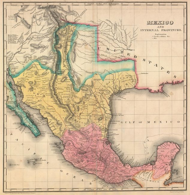
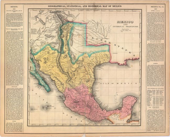
"Geographical, Statistical, and Historical Map of Mexico", Carey & Lea
Subject: Southwestern United States & Mexico, Texas
Period: 1822 (circa)
Publication: A Complete Historical, Chronological, and Geographical American Atlas
Color: Hand Color
Size:
14.4 x 15 inches
36.6 x 38.1 cm
This detailed map of Mexico, Texas and the American Southwest is one of the earliest detailed maps of the region. Based largely on Von Humboldt's important map (1811), this map was published for an American audience at a time just prior to Austin's arrival in Texas. The settled parts of Texas are confined along the Gulf of Mexico and the Rio Grande River with the northern area blank except for a few rivers and the Spanish Trail from the Red River to Santa Fe. The northern portion of the map covers the little-known parts of present-day Utah, Arizona and New Mexico. It shows several fictitious geographic features in the Great Basin and notations that were compiled by the Escalante expedition of 1776-77. The Santa Cruz River of southern Arizona is still not shown and Tucson is misspelled Tubson. The map identifies topographic features, mines, presidios, military posts, and Native American inhabitation. The title within the map is Mexico and Internal Provinces. It is flanked by text containing economic, political, social and historical data. Size with text is 20.4 x 16.5". The map was drawn by J. Finlayson and engraved by Young and Delleker.
References: Day #360, p. 13.
Condition: B
A crisp impression with centerfold separations at top and bottom that enter 1" and 5" into the image respectively, closed on verso with archival tape. There are a few spots of foxing and a couple of faint stains in the image.