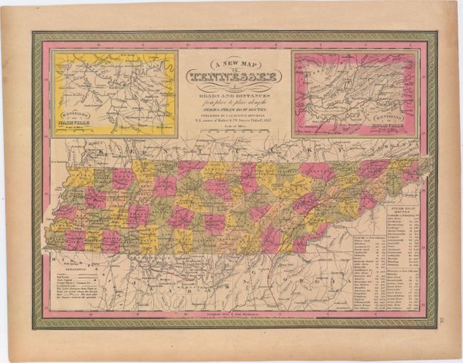
"A New Map of Tennessee with its Roads and Distances from Place to Place Along the Stage & Steam Boat Routes", Mitchell, Samuel Augustus
Subject: Tennessee
Period: 1847 (dated)
Publication: A New Universal Atlas
Color: Hand Color
Size:
15.3 x 11.3 inches
38.9 x 28.7 cm
This is one of the few mid-19th century maps that depicts Tennessee without Kentucky. It identifies counties, county seats, roads, railroads, and canals and also shows topographical detail. Two insets flank the script title: Environs of Nashville, and Environs of Knoxville. A table lists the stops and distances along three steamboat routes: from Nashville to New Orleans, from Nashville to Pittsburgh, and from Florence to New Orleans. The county configuration is circa 1842, with the recently organized Macon County, but prior to the organization of Putnam County (1842) and Lewis County (1843).
References:
Condition: B+
Original color with light toning.