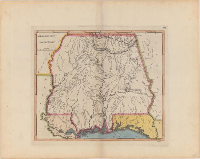
"Mississippi Territory", Carey, Mathew
Subject: Mississippi & Alabama
Period: 1814 (circa)
Publication: General Atlas
Color: Hand Color
Size:
14 x 12 inches
35.6 x 30.5 cm
Mathew Carey was a seminal figure in early American publishing; establishing the first publishing firm to specialize in cartography and issuing the first atlas devoted exclusively to American maps. He set up an elaborate cottage system of craftsmen for compiling, engraving, printing, and coloring maps. This practice was emulated by later American cartographic publishers such as John Melish and Henry S. Tanner. The American Atlas concept was also adopted by other publishers in both the United States and Europe.
This early map of Mississippi Territory covers the region of present-day Mississippi and Alabama. At the extreme northwest corner of the map is Fort Pickering on Chickasaw Bluff, near the future site of Memphis. Numerous Indian tribes and villages are located along with a few early settlements and forts. Indian trails and early roads are shown.
References:
Condition: A
A strong impression and original outline color with just a bit of soiling in the blank margins. What appears to be centerfold toning is actually show through of the backstrap.