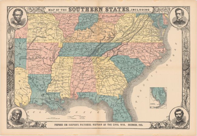
"Map of the Southern States, Including Rail Roads, County Towns, State Capitals, County Roads, the Southern Coast from Delaware to Texas, Showing the Harbors, Inlets, Forts and Position of Blockading Ships", Harper's Weekly
Subject: Southern United States
Period: 1863 (dated)
Publication: Harper's Pictorial History of the Civil War
Color: Hand Color
Size:
30.3 x 20.1 inches
77 x 51.1 cm
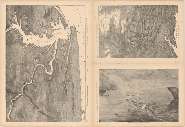
This terrific Civil War map shows good detail of the towns, villages, railroads, and the ship blockade of the south. The title continues along the bottom: "Prepared for Harper's History of the Rebellion. December, 1863." Surrounded by a very decorative border, it features portraits at each corner of Lincoln, Seward, Gen. Scott, and Gen. McClellan. An inset of "Florida. Southern Part." lies at lower right. On the verso are three black and white wood engraved birds-eye views, two single page and a large double page. The double page view details the region around the Chesapeake Bay and is titled "Pictorial Map of Portions of Delaware, Maryland, Virginia, and North Carolina…" The other two are "Balloon View of Fortress Monroe and Hampton Roads" and "Balloon View of the Seat of War." An uncommon issue.
References: cf. Stephenson (CW) 14.55, 32.9, 37.
Condition: A
Issued folding with terrific original coloring, full margins, and a dark impression. There is a small split at the fold intersection at center, faint toning along the fold at bottom, and some small damp stains along the sheet's edges, well away from image.