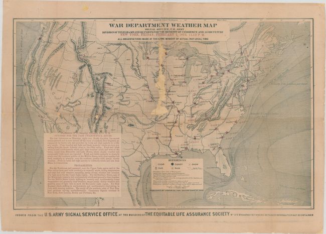
"War Department Weather Map Signal Service, U.S. Army Division of Telegrams and Reports for the Benefit of Commerce and Agriculture…", U.S. War Department
Subject: United States
Period: 1873 (circa)
Publication:
Color: Printed Color
Size:
22.3 x 14.1 inches
56.6 x 35.8 cm
War Department weather maps were published by the Signal Service beginning in January of 1871. With the development of the telegraph network over the 1840s and 1850s, it became possible to create a system of observations over the entire country. As the title indicates, the primary beneficiaries of this information were intended to be merchants and farmers, and the Signal Service provided these maps on a daily basis to aid in their operations.
The map itself is dated February 7, 1873 at 11:12 pm, and consists of observations from over 50 different locations with each site reporting temperature, barometric pressure and wind speed. Based upon the collection of readings, precipitation forecasts could be developed and depicted on the map. Along with the map is a text summary of the previous day and a forecast. A note below the map indicates that it was produced at "the building of The Equitable Life Assurance Society … where detailed information may be obtained."
References:
Condition: C+
Backed with heavy tissue to reinforce and repair an area of loss along the top half of the centerfold ranging in width from 0.25" to 0.5" with one area of about 1" at the center of the image. There are a few other small chips and separations along the horizontal fold. A small amount of image has been replaced in facsimile.