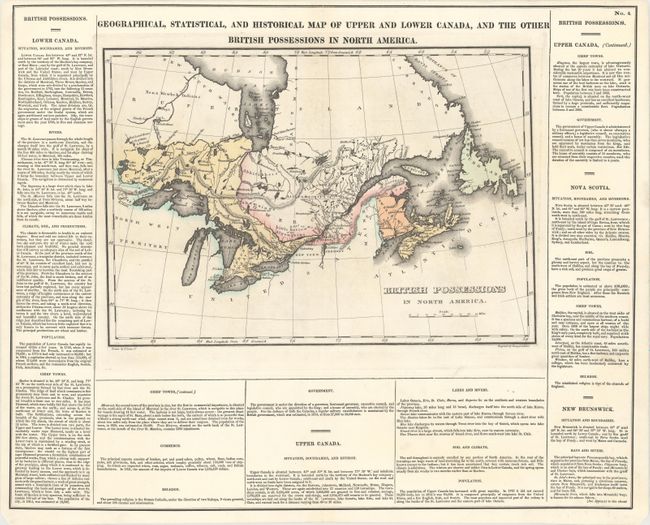
"Geographical, Statistical, and Historical Map of Upper and Lower Canada, and the Other British Possessions in North America", Carey & Lea
Subject: Canada
Period: 1822 (circa)
Publication: A Complete Historical, Chronological, and Geographical American Atlas
Color: Hand Color
Size:
14.1 x 9.9 inches
35.8 x 25.1 cm
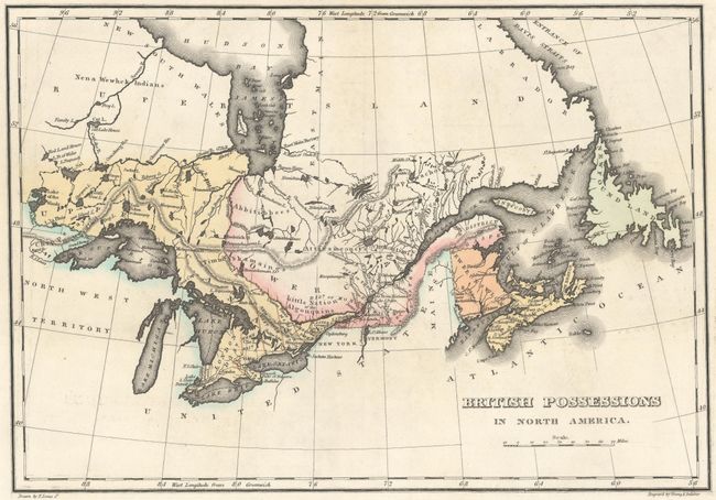
This map, alternately titled British Possessions in North America, appears on a full folio sheet (20.4 x 16.6") and is surrounded by English text describing the topography, climate, population, and major towns in Lower Canada, Upper Canada, Nova Scotia, and New Brunswick. The map includes the Great Lakes and extends to the west as far as the Lake of the Woods and east to Newfoundland. Part of Hudson Bay is shown. In Upper Canada are Gloucester, Osnabugh, Henley, Michpecoten Cat Lake, and Red Land Houses of the Ojibwa. Montreal and Quebec appear in Lower Canada. Drawn by Fielding Lucas, Jr. and engraved by Young and Delleker.
References:
Condition: A
Original color. A dark impression with faint offsetting and short professionally repaired centerfold separations at top and bottom.