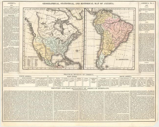
"Geographical, Statistical, and Historical Map of America", Carey & Lea
Subject: Western Hemisphere - America
Period: 1822 (circa)
Publication: A Complete Historical, Chronological, and Geographical American Atlas
Color: Hand Color
Size:
15.2 x 8.5 inches
38.6 x 21.6 cm
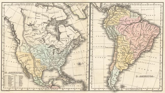
This full folio sheet (20.8 x 16.4") features two maps, showing North and South America, surrounded by text. Within the United States, Arkansa takes up a portion of the south central region, present-day Wisconsin and Minnesota are the North West Territory, and much of the west is labeled as Missouri. Texas, the Southwest, and California are part of the Internal Provinces. Alaska is not shown, but the map extends to and names Prince William Sound. On the map of South America, the United Provinces (United Provinces of the Rio de la Plata) take up most of the central part of the country, while the southern tip is named Patagonia. The surrounding text discusses topography, political divisions, and the European exploration of the continents. Drawn by J. Finlayson and engraved by Young and Delleker.
References:
Condition: B+
Original color with minor offsetting and faint toning along the centerfold. Centerfold separations at top and bottom and a short edge tear have all been professionally repaired. Narrow top margin, as issued.