Subject: Jamaica
Period: 1674 (published)
Publication: Henri Justel's Recueil de divers voyages faits en Afrique et en l'Amerique
Color: Black & White
Size:
12.5 x 10.8 inches
31.8 x 27.4 cm
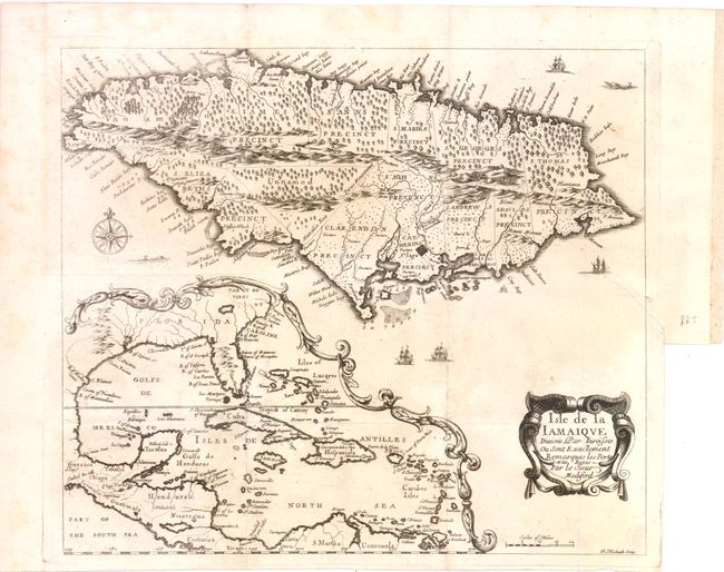
A French version of Richard Blome's map of Jamaica, drawn from the surveys ordered by Sir Thomas Modyford, governor of Jamaica in 1664-70. The map is based on John Ogilby's prototype with the island divided into its parishes. Ports and bays are identified and the mountainous terrain is shown by shading. Of particular interest is the large inset map of the entire Caribbean and southern portion of North America. It presents the standard cartographic information of the period with the Mississippi River placed too far to the west and a large spurious lake in present-day Georgia. It does not reflect the English presence in Carolina - the Caroline place name is that of the old French fort.
References: Burden #440; Kapp #18.
Condition: B+
Issued folded, now flattened. The right margin is trimmed for binding with a 2" binding tear repaired with light tissue on verso.