Subject: Gulf of Mexico and Caribbean
Period: 1705 (circa)
Publication: Nouveau Voyage autour du Monde
Color: Black & White
Size:
11.3 x 6 inches
28.7 x 15.2 cm
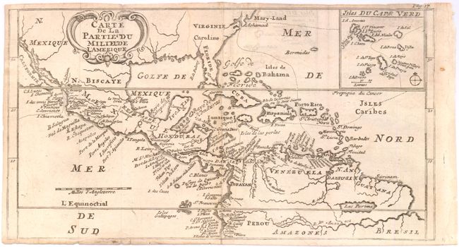
This chart shows part of the route of William Dampier's first circumnavigation voyage in the 1680s with his passage across the isthmus of Panama. The map covers the area of northern South America through Central America into what is now the southern United States with Mary-Land, Virginie, Caroline, Floride, and N. Mexique named. There is an inset map detailing the Cape Verde Islands with the route of exploration delineated. On the map California is named as an island although only the southern portion is shown. Not noted in McLaughlin. From the French edition of Dampier's New Voyage Round the World.
References:
Condition: B+
Dark, strong impression. Creases at one fold with some light toning. Close margins on three sides, as issued.