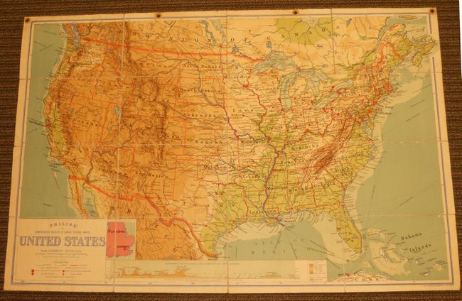
Subject: United States
Period: 1905 (circa)
Publication: The London Geographical Institute
Color: Printed Color
Size:
70 x 44.3 inches
177.8 x 112.5 cm
This interesting map of the United States at the turn of the 20th century identifies main railways, canals, steamship routes and towns by population. Of particular note on the map are Idaho Falls, which was previously named Eagle Rock until the townspeople voted to rename it in 1891; and Flagler's famous East Coast Railway, which was not extended to Key West until 1908. An inset map of part of England and Wales is drawn to scale to serve as a size comparison. The map also includes an elevation view titled, "Diagrammatic Section between Cape Mendocino & Cape Hatteras" and a color key to the elevations shown on the map.
References:
Condition: B+
Segmented map, linen backed, with block printed color. Some minor chipping with two areas in Texas replaced with paper, but overall good condition for a map of this size.