Subject: United States
Period: 1852-54 (circa)
Publication: Royal Illustrated Atlas of Modern Geography
Color: Hand Color
Size:
20.5 x 16 inches
52.1 x 40.6 cm
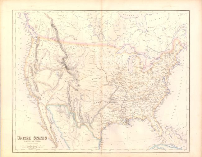
An uncommon map with interesting western territories. Dakota Territory is yet to be organized, with the large Minnesota Territory extending to the Missouri River. A huge Nebraska Territory extends from the Missouri River to the Continental Divide where it meets the oversized Oregon Territory, and south all the way to Texas and Indian Territory. The Texas panhandle extends to the Arkansas River. The large Utah Territory stretches between California and Nebraska encompassing present-day Nevada and Colorado. New Mexico Territory features the pre-Gadsden Purchase border. Good detail of topography and watershed, and many place names.
References:
Condition: A
Nice example on thick paper with full margins. Hint of centerfold toning that is more likely just show through of back strap.