Antique Maps, Charts, Atlases and Globes for Sale at Auction

Old World Auctions - Antique Map Specialists


Antique Map Auction Sale No. 136 - closed 6/1/2011

Featuring 845 lots of rare antique maps, charts, pocket maps, globes and atlases
Prices Realized       Table of Contents       Search Auction


Lot #81: "Carte d'Amerique divisee en ses principaux Pays Dressee sur les Memoires les plus recents, et sur Differents Voyages" Jean Baptiste Louis Clouet

Antique map chart Carte d Amerique divisee en ses principaux Pays Dres
Click to see full size image(s)

Estimate:
$600.00 - $750.00
Sold for: $350.00

Lot 81
By: Jean Baptiste Louis Clouet
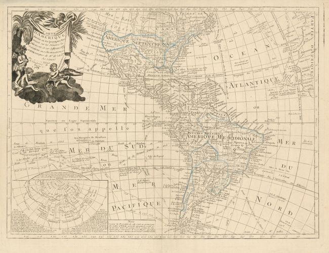
Subject: Western Hemisphere - America
Date: 1787

Publication:

Condition: A
See Condition Guidelines

Color: hand color

Size: 25 x 18.5 inches
63.5 x 47.0 cm

This scarce map exhibits some speculative cartography on the Pacific coast of North America. A huge Mer ou Baye de l'Ouest dominates the northwest coast, but a tentative coastline also reflects the Russian discoveries in the region. The large inset map illustrates the theories of Joseph Delisle and Philippe Buache concerning the potential Northwest Passage and the Sea of the West. In the Pacific, the tracks of early explorers are shown, including Quiros, Mendana, Le Maire, Magellan, and Antoine. This is one of the scarcest of all maps illustrating the Sea of the West.

Partially colored in outline. The impression in the map is a bit weak, else fine.


Ref: McGuirk #123.

Search this archived auction | Antique Map Price Guide