Subject: Caribbean
Period: 1837 (dated)
Publication: Atlas Universel de Geographie Physique, Politique et Historique…
Color: Hand Color
Size:
20.3 x 14.3 inches
51.6 x 36.3 cm
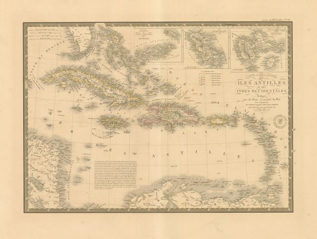
This is an attractive and very detailed map describing the West Indies with insets of the Virgin Islands, Martinique and Guadeloupe. Beautifully engraved with a very fine line on heavy paper. A touch of outline color along the shorelines of the individual islands provides a delicate accent that is characteristic of Brue's style. Here, the outline color reflects colonial claims, including those of France, England, Spain, Denmark, Holland, and Sweden. With Brue's embossed seal and surrounded by a decorative keyboard-style border that indicates longitude from Paris. Fancy title lettering embellished with flourishes.
References:
Condition: A
Lovely original hand coloring and fine impression with huge margins. Faint offsetting that does not distract.