Subject: Asia
Period: 1736 (circa)
Publication:
Color: Hand Color
Size:
15.5 x 11.8 inches
39.4 x 30 cm
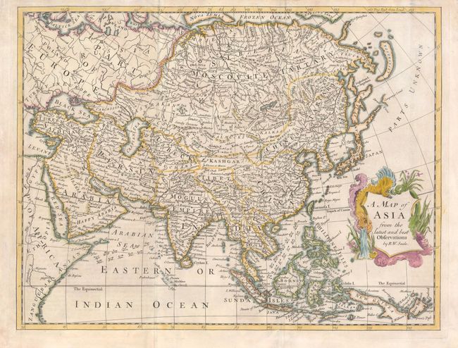
A surprising amount of information is included in Seale's map of Asia. It does not appear to be a copy of another map, but instead brings together numerous sources. The depiction of the northeast coastline is particularly interesting with Cape Tabin (Nofs Tfalatfkoi) protruding out between two spurious landmasses labeled Unknown Land and Pogukotski. The Land of Jedso is formed by two islands and a small portion of the coast of Companys Land is all that is seen of the Parts Unknown to the east. The trade winds are shown in the South China and Arabian Seas. The southern part of the Arabian peninsula is labeled Happy Arabia, which is a translation of the Latin Arabia felix.
References:
Condition: A
The two vertical folds are reinforced with tissue on verso and there is some faint toning.