Subject: Arabia, Yemen
Period: 1789 (dated)
Publication:
Color: Hand Color
Size:
14.5 x 22.4 inches
36.8 x 56.9 cm
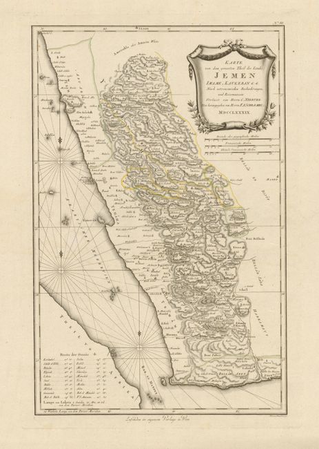
This is a scarce, detailed and finely engraved map of Yemen that was published from Vienna by F.A. Schraembl. The geography is based on the observations of the Danish explorer Carsten Niebuhr and shows the eastern shore of the Red Sea just to the north of Jizan. Numerous towns, cities, and Wadis are shown interlaced in the dense hachuring to suggest topography. The Red Sea is filled with three compass roses, fleur-de-lis and rhumb lines. In the lower left an index gives latitude and longitude for the major cities. At upper right is an elaborate title cartouche with three distance scales below. A bold and graphically striking map on a very large (23" x 33") sheet of hand laid paper.
References:
Condition: A
The map image is fine, but there is a little toning or soiling along bottom edge on very wide (5") margin. On thick paper with enormous margins this map has never been folded.