Subject: Holy Land
Period: 1755 (dated)
Publication: Atlas methodique
Color: Hand Color
Size:
23 x 18.7 inches
58.4 x 47.5 cm
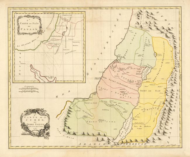
This scarce map shows the Holy Land divided into the Twelve Tribes. A large inset at top illustrates the land of Canaan before the conquest by the Israelites. This chart (map 2e) includes several place names, which were not included in the comparative map 1e that is included in Laor's collection. Engraved by John Gibson. Jean Palairet was born in Montauban, France, but emigrated to England where he became a French tutor to the children of George II. He wrote several educational texts and atlases. His most important work, the Atlas methodique, presented the maps in various stages of political definition.
References: cf Laor #553.
Condition: B+
Sharp impression and original color with some light toning and offsetting. A separation on the top fold that enters 2" into the map is closed with archival tape on verso. There is an extraneous horizontal fold.