Subject: Arctic and Scandinavia
Period: 1713 (published)
Publication: Universus Terrurum Orbis Scriptorum
Color: Black & White
Size:
6.7 x 4.8 inches
17 x 12.2 cm
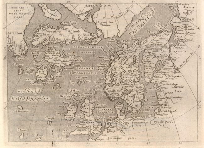
This small map is based on Ortelius' Septentrionalum of 1570, which in turn was based on the mapping of Nicholas Zeno in 1558. The map shows two Greenlands, one just above the other, as well as the imaginary islands of Frisland and St. Brendain, along with many other small, phantom islands in the North Sea. The North Pole carries a note of Pigmei hic habitant, indicating that pygmies live there. The island of Drogeo shown off the coast of Estotilant is thought to represent Newfoundland. Beautifully engraved by Girolamo Porro, the map had a long publishing history; first published in Magini's edition of Ptolemy in 1597 and last issued in Raphael Savonarola's Universus Terrurum Orbis Scriptorum in 1713. On a full sheet (7.7 x 11.7") of Italian text.
References: Burden #94.
Condition: A
A crack in the copper plate is visible at bottom, else fine.