Subject: Arizona
Period: 1912 (published)
Publication: Sen. Doc. No. 316, 64th Cong., 1st Sess.
Color: Hand Color
Size:
17.4 x 22.2 inches
44.2 x 56.4 cm
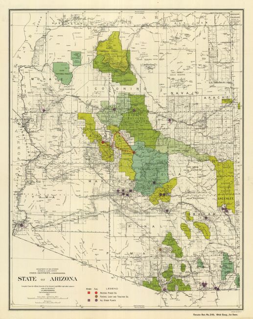
Arguably the most scarce and desirable of the Arizona GLO series is this Statehood map. It is a colorful and fascinating map filled with great detail issued in the year of statehood. The primary focus of the map is the identification of the numerous National Forests and the production of electrical power. The key at bottom identifies power plants owned by Arizona Power Co., Federal Light & Traction Co., and "Other Plants" with different symbols to indicate if the plant is hydro or fuel powered. The National Forests are attractively colored in complementary shades of green. Shows the extent of Indian reservations with details of counties, cities, roads and railroads, and much more. Locates the huge Grand Canyon Nat'l Game Preserve and the Grand Canyon National Monument. A beautiful, flawless example of this desirable map that was apparently issued in smaller quantities that most of its predecessors.
References:
Condition: A+
Small edge tear at right closed on verso. Folding as issued with fine, bright color on clean paper with full margins.