Subject: Northwestern United States
Period: 1856 (circa)
Publication:
Color: Hand Color
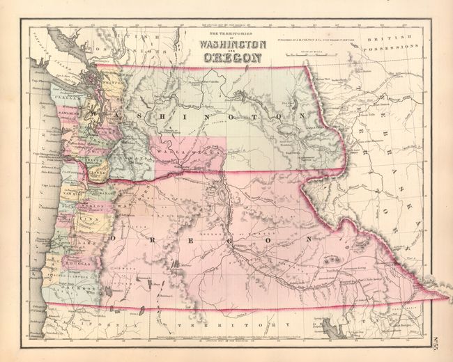
1) The Territories of Washington and Oregon, from General Atlas (15.5 x 11.8") This great map of the Pacific Northwest shows both territories extending to the Continental Divide and that region that would become Idaho. Of specific interest is the notation of all the major exploration routes, wagon trails and the proposed routes for the transcontinental railway as explored by Gov. Stevens. The organized counties of both Oregon and Washington are confined west of the mountain ranges except for Skamania and Walla Walla Counties. With the neatline border. Includes the descriptive text page with fascinating information on the territories. Original margins, fine impression and original color. (A)
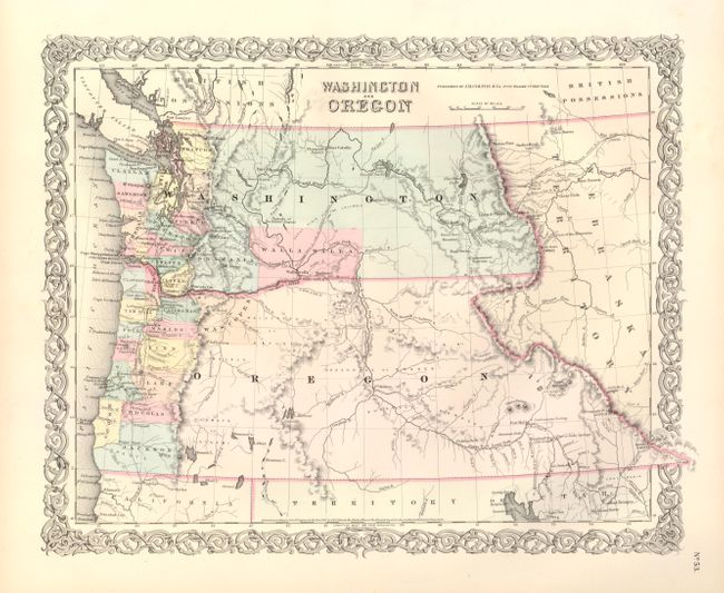
2) Washington and Oregon, from Atlas of the World (16 x 12.5") This map of the Pacific Northwest shows Washington and Oregon Territories in the same configuration as the map above including railroads, routes of exploration, etc. All details are virtually identical even though this edition is smaller even though strapwork border gives the appearance of it being larger. First edition with the imprint of J.H. Colton. With full, original margins, fine impression and original color. (A+)
References:
Condition:
See individual descriptions.