Subject: United States and Canada
Period: 1836-41 (dated)
Publication: Tanner's Universal Atlas
Color: Hand Color
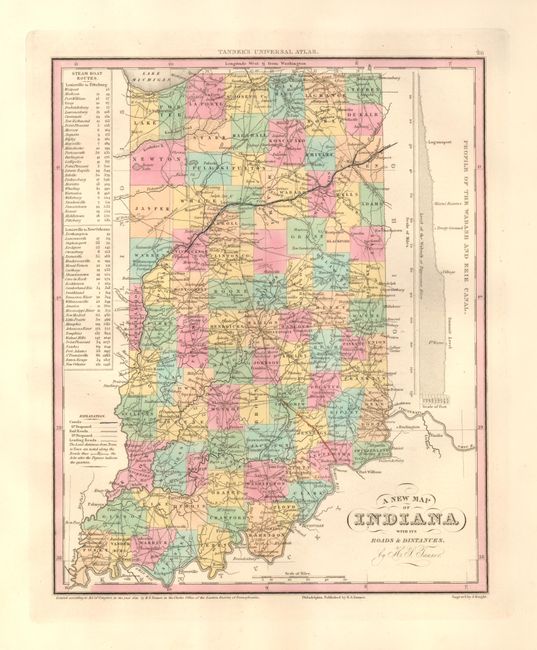
1) A New Map of Indiana with its Roads & Distances, 1841, (10.5 x 12.8"). Finely detailed map of the state locates all towns and villages, counties, watershed and more. A table gives the steamboat routes with point to point distances from Louisville to Pittsburgh and from Louisville to New Orleans. Land distances between towns are noted along the roads. Railroad and canals are also shown.
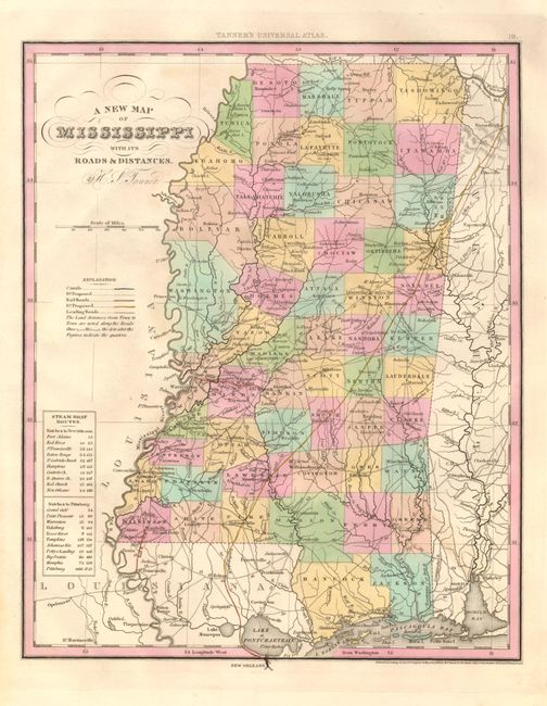
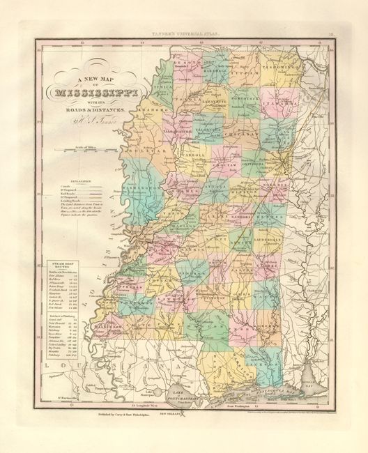
2 & 3) A New Map of Mississippi with its Roads & Distances, 1836, (10.5 x 12.8"). Early county configuration, particularly in the northeast part of the state. A legend notes the steamboat routes with point to point distances from Pittsburgh to New Orleans. Land distances between towns are noted along the roads. Railroad and canals are also shown.
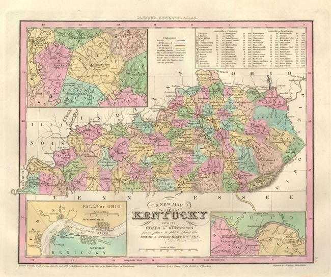
4) A New Map of Kentucky with its Roads & Distances, 1839, (13.2 x 10.5"). This handsome map includes steamboat routes and other details above. It also includes three insets of the vicinity of Lexington, the Falls of the Ohio, and a section along the Ohio River including Washington and Clarksburg.
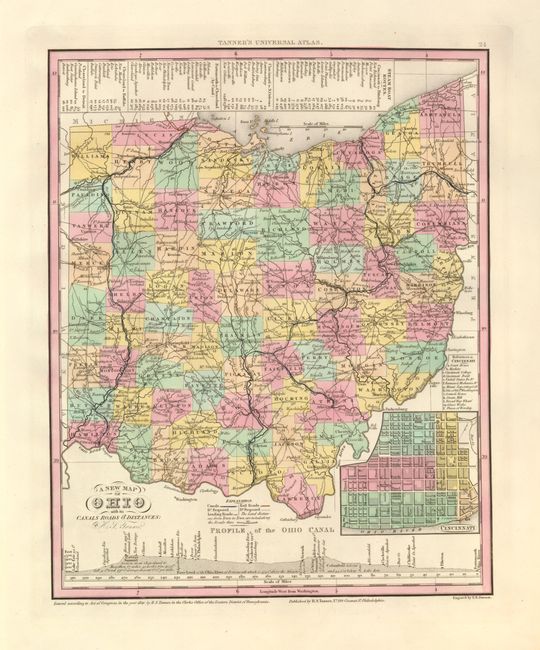
5) A New Map of Ohio with its Canals Roads & Distances, 1841, (10.5 x 13"). Fine early map showing counties, roads, railroads, canals and settlements. Includes an inset Cincinnati City Plan and a Profile of the Ohio Canal. Lucas and Carroll Counties have been added and Port Lawrence has been renamed Toledo since the 1834 edition. The Toledo Strip is shown with both the Old Boundary and New Boundary with Michigan. This strip of land was the source of a major boundary dispute between the two states that resulted in the infamous Toledo War. A table at top gives the steamboat routes with point to point distances between various cities to include New Orleans, Pittsburg, Cincinnati, Portsmouth, Cleveland, Buffalo and Detroit.
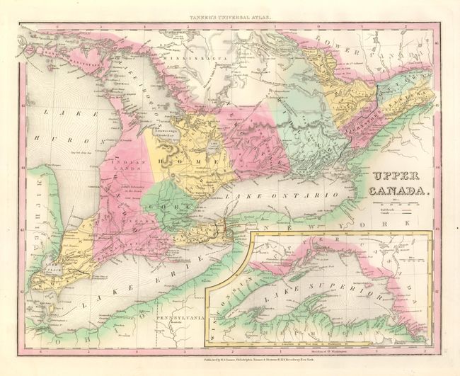
6) Upper Canada, (14.8 x 11.6"). This map extends from Detroit northeast to include Lake Erie, Lake Ontario, Niagara Falls, Toronto and along the St. Lawrence to Cornwall. Large inset details Lake Superior.
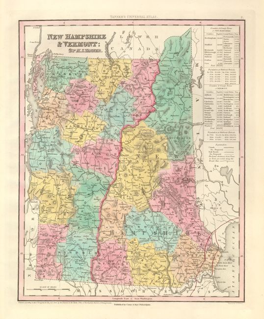
7) New Hampshire & Vermont, 1840, (11 x 14"). A table at top gives the populations by county for both states plus a historical population comparison by each census taken up to 1840.
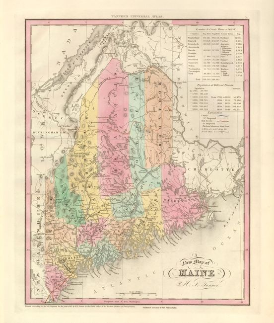
8) A New Map of Maine, 1840, (11 x 14"). A table at top gives the populations by county plus a historical population comparison by each census taken up to 1840, including a number from 1765.
References:
Condition: A+
These eight maps are superb examples with fine color, dark impression and clean paper.