Subject: Colonial United States and Canada
Period: 1740 (circa)
Publication:
Color: Hand Color
Size:
21.8 x 19.8 inches
55.4 x 50.3 cm
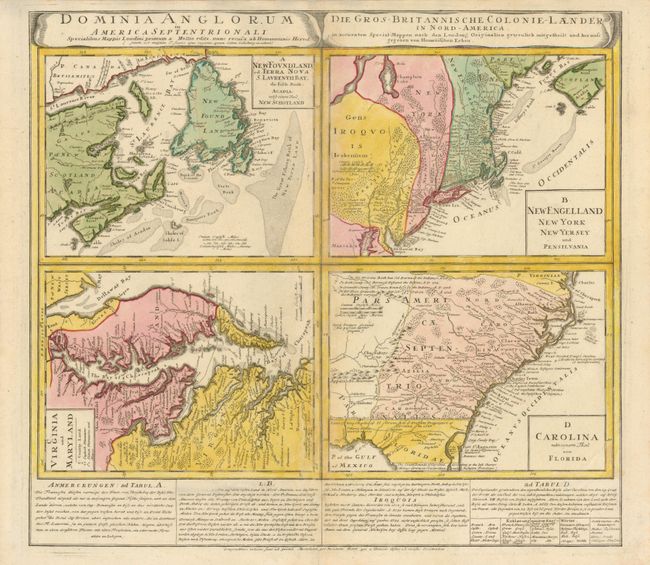
This great sheet consists of four separate maps: Virginia und Maryland; Carolina nebsteinem Theil von Florida; New Engelland, New York, New Yersey und Pensilvania; and New Foundland, od. Terra Nova, S. Laurentii Bay, die Fisch-Bank, Acadia, nebst einem Theil New Schotland. Each map details the British possessions in North America, with roads, forts, towns, coastal shoals. Text panel at bottom. German title at right, Die Gros-Britannische Colonie-Laender in Nord America.
References: Cumming (SE) #233; McCorkle #740.1; Portinaro & Knirsch #123; Sellers & Van Ee #83.
Condition: B+
Faintly toned on centerfold, which has been reinforced on verso with tissue.