Catalog Archive
Auction 130, Lot 739

"[Tabula Duodecima Asiae continet Taprobanam insulam]", Ptolemy/Fries
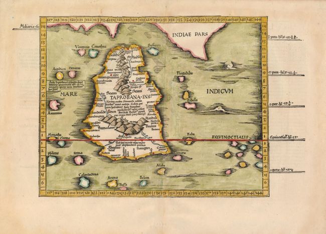
Subject: Sri Lanka

Period: 1541 (published)

Publication: Claudii Ptolemaei Alexandrini Geographicae

Color: Hand Color

Size:
14.5 x 11 inches
36.8 x 27.9 cm
Download High Resolution Image
(or just click on image to launch the Zoom viewer)

This is a great woodblock map of the island of Taprobana, which was variously thought to be Ceylon (Sri Lanka) or Sumatra. This map depicts Ceylon with the typical misconceptions of Ptolemy showing the island greatly enlarged, surrounded by imaginary islands, and with a small part of India incorrectly drawn in the northeast corner of the map. Toprobana was drawn too large on most early maps due, in part, to its importance to trade between the Europe and Southeast Asia. Also Marco Polo stated that the island had a circumference of 2400 miles and had been larger in the past. The Latin title is on verso.

References:

Condition: A

Sharp impression and wide original margins.

Estimate: $400 - $500

Sold for: $300

Closed on 12/2/2009

Archived