Subject: Pakistan, Afghanistan and Northern India
Period: 1625 (published)
Publication: Purchas His Pilgrims
Color: Hand Color
Size:
14.5 x 10.8 inches
36.8 x 27.4 cm
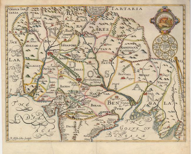
This early, influential map covers the region from modern-day Afghanistan through northern Indian and Nepal to Myanmar (Burma); then the great Mughul Empire. It is a re-engraved version of the first modern map of northern India that was prepared by William Baffin and Sir Thomas Roe. Baffin drafted the map from information collected by Roe while he was Britain's first ambassador to India (1615-19) and it was engraved by Renold Elstracke. The map was then re-engraved by Elstracke for publication in Samuel Purchas' great five-volume book of voyages and travels, in which it was widely distributed. In this version, Elstracke corrected several errors in the original plate and rearranged the decorative elements. The map provides a great amount of information on the provinces, towns, rivers and roads. One of the most prominent features which first appears on the Baffin-Roe map is the Longe Walke, the route lined with trees between the palaces at Agra and Lahore. This important map remained the standard for most European maps of the Mughul Empire well into the eighteenth century.
References:
Condition: B+
A faint spot near cartouche, a short repaired tear that just enters the map at top, and a few minor creases, else very good.