Subject: Asia
Period: 1730 (circa)
Publication:
Color: Hand Color
Size:
22.3 x 19 inches
56.6 x 48.3 cm
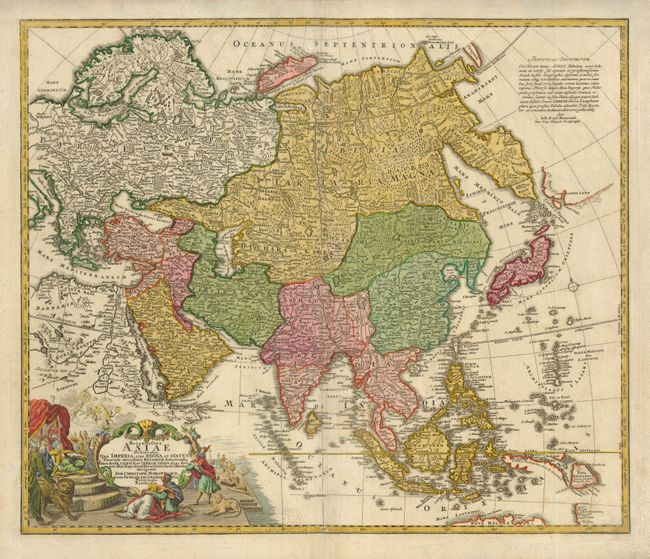
This map is a revision of the elder Homann's Asian map of circa 1712. The most important innovation is the addition of a huge Kamchatka Peninsula labeled Kamtzadalia Sinis Jeso with the southern tip marked Kurilorum Regio - an early reference to the Kuril Islands. Japan is separated from the Kamchatka Peninsula by a cluster of smaller islands. East of this archipelago, and separated from it by a narrow strait identified as the Canal de Piecko, is a coastline of Campagnie Land. Another notable difference is the depiction of the Caspian Sea based on the 1722 surveys of Karl van Verden. In South East Asia the straits between New Guinea and Australia still appear in a tentative fashion, noting Dampier's Strait and a disembodied Carpenteria with no definite northern limit. The map is decorated with the same title cartouche as the elder Homann's map, featuring an Asian queen holding court, but the upper cartouche has been replaced with a simple block of text.
References: Yeo #123.
Condition: B+
Attractive old color and a sharp impression with some light toning and surface soil.