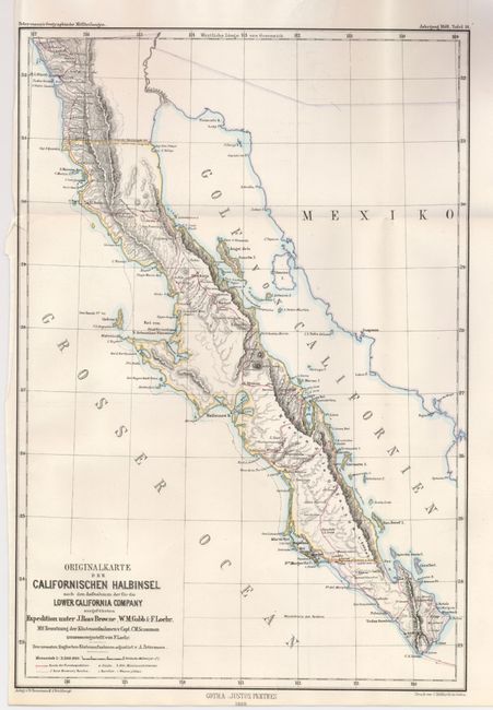
Subject: Mexico
Period: 1868 (dated)
Publication: Geographische Mittheilung
Color: Hand Color
Size:
9 x 13 inches
22.9 x 33 cm
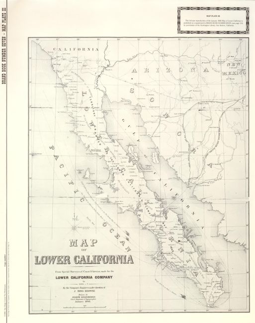
This map shows the Baja in its entirety with excellent detail for the period. The survey was conducted by J. Ross Browne, Company Engineer, in the years 1866 and 1867. This is a German edition that was published from Gotha with the typical fine engraving and lovely hand coloring we see in German produced maps. Some of the hand coloring is layered, a technique normally reserved for fine engravings, giving the map an artistic look. It shows the towns of Todos Santos, La Paz, Loreto, Mulege and many small villages like San Quentin and La Ensinada to name a few. A most uncommon map that was drawn by Joseph Goldsheider, Civil Engineer and Topographer in January of 1868.. The lot includes a reproduction map of the English version in b&w. It was published by the San Diego Corral "The Westerners" from the map at the Huntington Library (1983) . (14.5" x 18")
References:
Condition: A+
The original is folding as issued. Very fine impression and color. Original margins are close at left from binding, as issued.