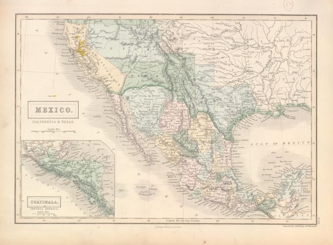
Subject: United States, Texas & Mexico
Period: 1851 (circa)
Publication: Black's General Atlas
Color: Hand Color
Size:
14.5 x 10 inches
36.8 x 25.4 cm
Nice edition which still labels California as Upper or New California, but the border clearly matches California's boundaries as we know them. This map is likely from California's military government status prior to achieving Statehood in 1850. The rivers of the Gold Region are well shown and hand colored in yellow. Ft. Sutter is located, but there is no direct mention of gold. The map features a pre-Gadsden Purchase border between Mexico and the United States. There is good detail of the Californian missions and early forts throughout the Southwest. Texas has its statehood border, but with the elongated panhandle. Texas is separately colored and the United States is uncolored. The territories of Utah and New Mexico are in their largest configuration. Inset map of Central America at lower left. Finely engraved by Sidney Hall. Many of Black's maps from this period combine some printed color with hand coloring, but this example is fully hand colored.
References:
Condition: A
Very nice example with just a little toning in blank margins. Backed with modern linen.