Subject: Galveston, Texas
Period: 1856 (dated)
Publication:
Color: Black & White
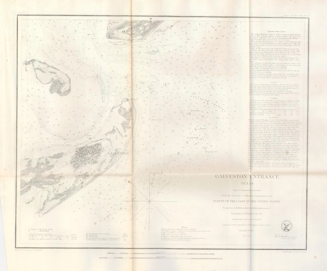
1) This coastal survey chart details the entrance to Galveston Bay. It includes a town plan of Galveston without naming the streets. The map extends to Pelican Island, Bird Key, and Bolivar Point. It locates buoys, a beacon, a light boat, and is filled with soundings, bottom types, extensive notations on sailing directions, tides, etc. Triangulations were accomplished in 1848 by R.H. Fauntleroy and J.S. Williams, the topography was accomplished in 1849 and 1850 by J.M. Wampler, while the hydrography was under the direction of USN Lieuts. T. A. Craven and A. S. Baldwin in 1851 and 1852. (17" x 13") A few tiny spots. Folding as issued. (B+)
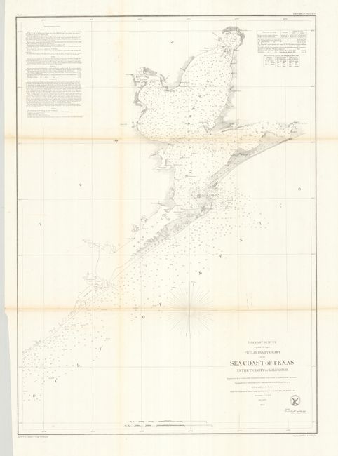
2) This coastal survey chart is from the same publication as the previous one. The map is centered on the town of Galveston, but continues northward to show the entire bay. It extends on the coast west beyond Oyster Bay, eastward beyond Bolivar Peninsula to Muscle and East Bay points. Details include buoys and beacons, a light boat, shoals, reefs, and is filled with soundings, bottom types, extensive notations on sailing directions, tides, etc. In Galveston Bay, the mouth of the San Jacinto is well shown, as is Turtle Bay. (19 x 25") Folding as issued. A little toning along two horizontal folds, otherwise a near flawless example. (B+)
References:
Condition:
See individual descriptions.