Subject: Philadelphia, Pennsylvania
Period: 1876 (dated)
Publication:
Color: Hand Color
Size:
21.5 x 20 inches
54.6 x 50.8 cm
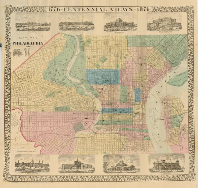
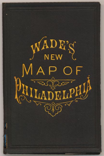
An attractive and detailed pocket map of Philadelphia that was published for travelers who had come to visit the World's Fair and to celebrate America's Centennial. The map is surrounded by a decorative grape-leaf border and eight finely engraved views of Centennial Exposition buildings including Machinery Hall, where people were introduced to the 1500 horsepower Corliss Steam Engine that was used to power 13 acres of machinery in the great hall. The map locates government buildings, theaters, hospitals, parks, railroads, ferries and steamship lines. Covers the city from the Byrd Orphan Asylum in the west to the Delaware River to include Petty's or Treaty Island and part of Camden. Blank verso. Folds into gilt-stamped cloth covers "Wade's New Map of Philadelphia" (3.6 x 5.8").
References:
Condition: B+
Map has fine original color. Small fold intersection splits and one short fold split at right just into border. Cover clear and bright with no wear except for a short split at lower edge of spine.