Subject: Oklahoma
Period: 1901 (dated)
Publication:
Color: Printed Color
Size:
22 x 14.4 inches
55.9 x 36.6 cm
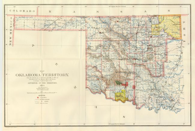
This map was compiled from the corrected map of the General Land Office 1898 and from data on file in the territorial office to accompany the Annual Report of the Governor of the Territory to accompany the Annual Report under the direction of Harry King, Chief of Drafting. It is an attractive map with great attention paid to detail, including railroads constructed and proposed, as well as roads and trails. The map covers present day western Oklahoma with the panhandle, but only the western portion of what was then Indian Territory is shown. Indian reservations within the territory are shown, including the Wichitas, Kiowas, Comanches and Apaches. Land Offices are located at Woodward, Alva, Enid, Perry, Guthrie, Kingfisher, Ft. Reno, Oklahoma City, Mangum and Lawton.
References:
Condition: A+
Folding as issued. Fine condition.