Subject: Massachusetts
Period: 1855 (dated)
Publication:
Color: Hand Color
Size:
29 x 19 inches
73.7 x 48.3 cm
The Office of Coast Survey is the oldest U.S. scientific organization, dating from 1807 when Congress directed that a "survey of the coast" be carried out. By 1836, it was called the U.S. Coast Survey and in 1878, the name was changed to the U.S. Coast and Geodetic Survey. Today the Office of Coast Survey is a division of the National Oceanic and Atmospheric Administration NOAA.
The survey teams, composed of civilians as well as Army and Naval officers, charted the nation's waterways and produced a wide array of reports, survey charts, hydrographic studies of tides and currents, astronomical studies and observations, and coastal pilots. These charts are an important record of the changing nature of the nation's coastlines. In additional to coastal charts, the U.S. Coast and Geodetic Survey produced land sketches, Civil War battle maps, and the early aeronautical charts.
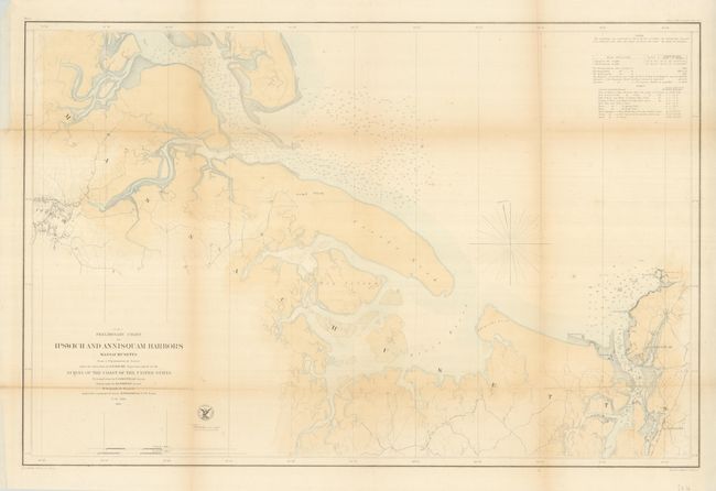
Sea chart of the coastline between Ipswich and Annisquam details soundings and the now famous lighthouses in the region. An inset locates the lighthouses and gives the heights of tides during the various times of year.
References:
Condition: B+
Issued folding, now pressed and backed with Japanese tissue. The folds are slightly toned.