Subject: Southwestern United States
Period: 1873 (circa)
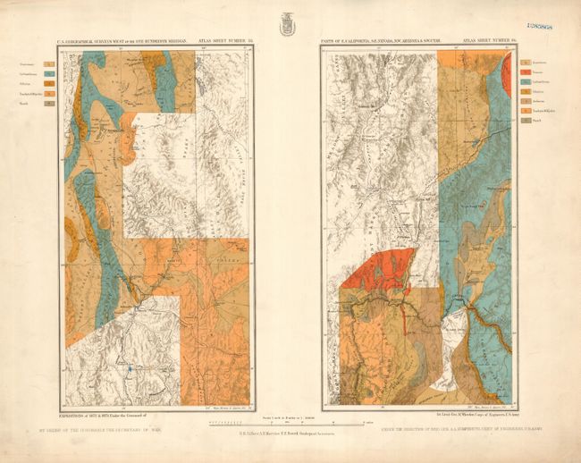
Publication: Topographical Atlas...Geographical Surveys West of The 100th Meridian
Color: Printed Color
Size:
21.8 x 15 inches
55.4 x 38.1 cm
Two rare lithographed maps on one large, unfolded, sheet. The map at left is the upper map, which aligns with the southern map at right. The maps locate Wheeler Peak, Pioche, Nevada, Virgin Hill, West Point, Boulder Canon (site of today's Lake Mead) and Black Canyon on the Colorado. There is good detail of the Virgin River as it flows to the west of the Virgin Range. The informative sheet shows wagon roads, ferry crossings, springs, telegraph lines, mines, and much more. Beautifully colored to indicate seven different geological formations. The maps are from Wheeler's expeditions of 1872 and 1873. Map by G.K. Gilbert, A.R. Marvine, E.E. Howell, Geological Assistants. Blank verso. This large folio sheet came from the rare atlas that was composed of 135 individual Topographical and Geological Atlas sheets.
References:
Condition: A
Nice example with just a little marginal toning, map image is fine. A blue number stamped in upper right margin.